This scale provides detail for the really committed navigator and map enthusiast. Studying the country down to its every wall and ditch gives real confidence in route finding and satisfaction in "reading" the landscape.
One of Wainwright's trade mark enjoyments was to examine the broader picture and to line up the hill tops in the surrounding area. Explorer maps are superb in this respect, but the downside is that you will need 8 of them: numbers 303, OL4, OL5, OL19, OL30, 304, OL26 and OL27
| |
|
These maps are available in two formats:
Paper - they fold well, and are backed with a reasonably durable laminated cover. They will remain intact, depending on how much wind and rain you have encountered!
Lam-Fold - extra strong lamination with a 'china-graph' write-on, wipe-off surface they are also tear resistant and waterproof. They are however, a little bulkier.
|
| |
|
Coast2Coast Suggestions |

|
|
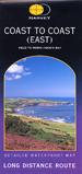
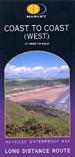
Our suggestion is to take along the OS Outdoor Leisure strip maps for simple route-finding but take along either the Explorer or Landranger series maps for detailed route finding or to spread out while you're having your picnic or savouring a view.
|
|
|
| |
| |
|
Map 303: Whitehaven & Workington, Cockermouth
|

click to enlarge
|
1:25,000; 2.5 inches to 1 mile; 4cm to 1km
Dimensions: 225 mm x 135 mm
|
|
|
|
|
|
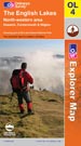
Map OL4: The Northern Lakes. North Western Area
|
click to enlarge
|
1:25,000; 2.5 inches to 1 mile; 4cm to 1km
Dimensions: 225 mm x 135 mm
|
|
|
|
|
|
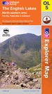
Map OL5: The Northern Lakes. North Eastern Area
|
click to enlarge
|
1:25,000; 2.5 inches to 1 mile; 4cm to 1km
Dimensions: 225 mm x 135 mm
|
|
|
|
|
|
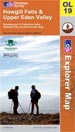
Map OL19: Howgill Fells & Upper Eden Valley
|
click to enlarge
|
1:25,000; 2.5 inches to 1 mile; 4cm to 1km
Dimensions: 225 mm x 135 mm
|
|
|
|
|
|
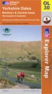
Map OL30: Yorkshire Dales. Northern & Central areas
|
click to enlarge
|
1:25,000; 2.5 inches to 1 mile; 4cm to 1km
Dimensions: 225 mm x 135 mm
|
|
|
|
|
|
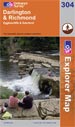
Map 304: Darlington & Richmond, Egglescliffe
|
click to enlarge
|
1:25,000; 2.5 inches to 1 mile; 4cm to 1km
Dimensions: 225 mm x 135 mm
|
|
|
|
|
|
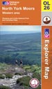
Map OL26: North York Moors. Western Area
|
click to enlarge
|
1:25,000; 2.5 inches to 1 mile; 4cm to 1km
Dimensions: 225 mm x 135 mm
|
|
|
|
|
|
Map OL27: North York Moors. Eastern Area
|
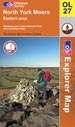
click to enlarge
|
1:25,000; 2.5 inches to 1 mile; 4cm to 1km
Dimensions: 225 mm x 135 mm
|
|
|
|
|
|
Coast2Coast Suggestions
|
|
|
Our suggestion is to take along the OS Outdoor Leisure strip maps for simple route-finding but take along either the Explorer or Landranger series maps for detailed route finding or to spread out while you're having your picnic or savouring a view.
|
|
|
| |
Ordnance Survey Landranger Maps

|
|
Scale 1:50,000; 2cm to 1km; 1� inches to 1 mile
Bear in mind that the Coast to Coast is not a designated long-distance footpath. You may be using a route-finder from one of the guidebooks but the detailed choices and deviations you may wish to take along the way are your own. One of Wainwright's trade mark enjoyments was to examine the broader picture and to line up the hill tops in the surrounding area. Landranger maps are excellent in this respect, but the downside is that you will need 8 of them: numbers 89, 90, 91, 92, 93, 94, 98 and 99. 50,000 is a good practical working scale in most situations, however, there are layout difficulties in the Swaledale area where the route switches on and off maps 92 & 98.
|
| |
| |
|
These maps are available in two formats:
Paper - they fold well, and are backed with a reasonably durable laminated cover. They will remain intact, depending on how much wind and rain you have encountered!
Lam-Fold - extra strong lamination with a 'china-graph' write-on, wipe-off surface they are also tear resistant and waterproof. They are however, a little bulkier.
|
| |
|
Map 89: West Cumbria, Cockermouth and Wast Water
|
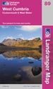
click to enlarge
|
1:50,000; 2cm to 1km; 1.25 inches to 1 mile
Dimensions: 225 mm x 135 mm
|
|
|
|
|
|
Map 90: Penrith & Keswick, Ambleside
|
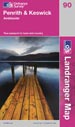
click to enlarge
|
1:50,000; 2cm to 1km; 1.25 inches to 1 mile
Dimensions: 225 mm x 135 mm
|
|
|
|
|
|
Map 91: Appleby-in-Westmorland area
|
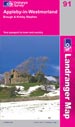
click to enlarge
|
1:50,000; 2cm to 1km; 1.25 inches to 1 mile
Dimensions: 225 mm x 135 mm
|
|
|
|
|
|
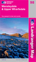
Map 98: Wensleydale & Upper Wharfedale
|
click to enlarge
|
1:50,000; 2cm to 1km; 1.25 inches to 1 mile
Dimensions: 225 mm x 135 mm
|
|
|
|
|
|
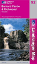
Map 92: Barnard Castle and surrounding area
|
click to enlarge
|
1:50,000; 2cm to 1km; 1.25 inches to 1 mile
Dimensions: 225 mm x 135 mm
|
|
|
|
|
|
Map 99: Northallerton & Ripon
|

click to enlarge
|
1:50,000; 2cm to 1km; 1.25 inches to 1 mile
Dimensions: 225 mm x 135 mm
|
|
|
|
|
|
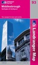
Map 93: Middlesbrough, Darlington & Hartlepool
|
click to enlarge
|
1:50,000; 2cm to 1km; 1.25 inches to 1 mile
Dimensions: 225 mm x 135 mm
|
|
|
|
|
|
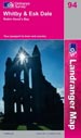
Map 94: Whitby & Esk Dale, Robin Hood's Bay
|
click to enlarge
|
1:50,000; 2cm to 1km; 1.25 inches to 1 mile
Dimensions: 225 mm x 135 mm
|
|
|
|
|
|
Coast2Coast Suggestions
|
|
|
Our suggestion is to take along a strip style map for simple route-finding but take along either the Explorer or Landranger series maps for detailed route finding or to spread out while you're having your picnic or savouring a view.
|
|
|
| |
| |